PHOTOS 1
Welcome to MY BEST HELSINKI PHOTOS 1
MOSTLY SUMMER PHOTOS. City views, islands, sunsets, shoreline walks, ferries, landmarks
We love Helsinki! In the summer it, and the surrounding islands, are gorgeous. Worth exploring.
on My Best Helsinki, are privately owned, copyrighted work © RCC Gelber. Please see copyright notice on bottom of the page.
Interested in buying our images? Please contact us. Thank You.
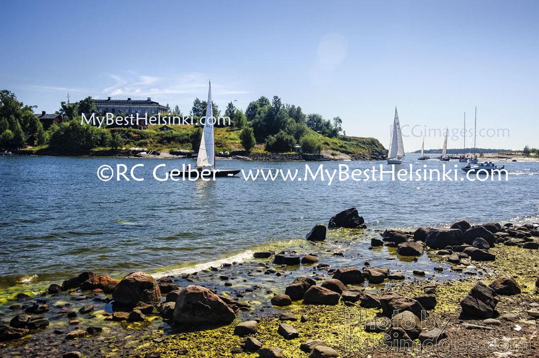
Walking along Kaivopuisto shore rpomenade, arriving in Meristama small boat harbor. Harakka Island to the left, and a sliver of Uunisaari island, a popular picnic destination, on the right. Harakka Nature Center.
Esplanade Park as viewved from Eteläesplanadi (South Esplanade) toward Pohjoisesplanadi (North Esplanade). A very popular spot when the weather is nice.

. Click photo for place names & larger view. © RC Gelber.")
Sunset view of Valkosaari and Klippan. In the background, to the right, you can see the old lighthouse on Suomenlinna island. Click for place names & larger view.


Above, some views from Liuskasaari, looking toward the mainland Helsinki and the neighborhood of Eira.
Helsinki is one of the best summer cities in the
world. It is surrounded by water -the Gulf of
Finland- and its coast is dotted with beautiful
islands, just minutes away from the heart of the
city, accessible by taxi boats.
Helsinki is clean
and pretty. It has lots of parks, large and small.
There are numerous cafés with outdoor seating
and restaurants with summer patios, on the
sidewalk or in a park area.
, that hosts a restaurant called -surprise- Klippan. - - All photos © RC Gelber. All Rights Reserved.")
The best way to learn to know Helsinki, and get around, is to walk. The second best is to use the tram.
Many of the trams have digital signs inside, naming every stop, making it easy to follow their route on a map.

Finns love to go to picnics in the summer. Some of the most popular destinations are the islands surrounding Helsinki. Many of them are city owned and are open to the public.
The most known of the islands is the historic Suomenlinna Fortress Island, that actually consists of several islands, lying close to each other, connected to each other by bridges.
Suomenlinna is on the World Heritage List.


View from Kaivopuisto park shore to Suomenlinna Island group. Särkkä island in the center, to the right of the pier.

Helsinki shoreline views from Särkkä island taxiboat, around midnight, late June. You can see a daytime view of Särkkä island in the image above.

The Helsinki Lutheran Dome, by the Senate Square

The North Esplanade, center of Helsinki.

Helsinki's Uspenski Cathedral, on Katajanokka.
Most photos on My Best Helsinki can be viewed in a larger format by clicking on the photos. Please see the copyright notice on the bottom of the page. Legal notice about unauthorized copying and / or posting of our images. interested in buying our images? Please contact us. Thank You.


Right: Walking around historic Katajanokka, including off the beaten path, is time well spent


The harbor, with ships to different destinations. The small hydrofoil in the front offers one of the fastest ways (1.5 hours) to get to Tallinn, Estonia. Behind the hydrofoil is the Silja Line
ship that parts every night for Stockholm. In the background to the left is the Viking Line ship that also sails to Stockholm.